Obock
Obock (also Obok, Hayyú) is a small port town in Djibouti. It is located on the northern shore of the Gulf of Tadjoura, where it opens out into the Gulf of Aden. The town is home to an airstrip and has ferries to Djibouti City. The French form Obock derives from Arabic "Oboh", deformation of Oboki, a name given to the Wadi Dar'i in its middle part, upstream of its coastal delta.
The fishing village was originally built on the plateau of Dala-h Húgub near the Dar'i Wadi, with some houses constructed of mud and stone and Daboyta. Most of the inhabitants earned their living through animal husbandry, fishing, commerce and used a well for drinking water. During the Middle Ages, Obock was ruled by the Ifat Sultanate and then the Adal Sultanate. The Sultans of Raheita emerged from the Adal Sultanate. Although nominally part of the Ottoman Empire since 1554, between 1821 and 1841, Muhammad Ali, Pasha of Egypt, came to control Yemen and the sahil, with Zeila and as far as Harar. On the 14 April 1884 the Commander of the patrol sloop L’Inferent reported on the Egyptian occupation in the Gulf of Tadjoura. The Commander of the patrol sloop Le Vaudreuil reported that the Egyptians were occupying the interior between Obock and Tadjoura. In actuality, however, Egypt had little authority over the interior and their period of rule on the coast was brief, lasting only a few years (1841–62). The Egyptian garrison was withdrawn from the area.
The fishing village was originally built on the plateau of Dala-h Húgub near the Dar'i Wadi, with some houses constructed of mud and stone and Daboyta. Most of the inhabitants earned their living through animal husbandry, fishing, commerce and used a well for drinking water. During the Middle Ages, Obock was ruled by the Ifat Sultanate and then the Adal Sultanate. The Sultans of Raheita emerged from the Adal Sultanate. Although nominally part of the Ottoman Empire since 1554, between 1821 and 1841, Muhammad Ali, Pasha of Egypt, came to control Yemen and the sahil, with Zeila and as far as Harar. On the 14 April 1884 the Commander of the patrol sloop L’Inferent reported on the Egyptian occupation in the Gulf of Tadjoura. The Commander of the patrol sloop Le Vaudreuil reported that the Egyptians were occupying the interior between Obock and Tadjoura. In actuality, however, Egypt had little authority over the interior and their period of rule on the coast was brief, lasting only a few years (1841–62). The Egyptian garrison was withdrawn from the area.
Map - Obock
Map
Country - Djibouti
 |
 |
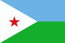
| Flag of Djibouti | |
In antiquity, the territory, together with Ethiopia, Eritrea and Somaliland, was part of the Land of Punt. Nearby Zeila, now in Somaliland, was the seat of the medieval Adal and Ifat Sultanates. In the late 19th century, the colony of French Somaliland was established after the ruling Dir Somali sultans signed treaties with the French, and its railroad to Dire Dawa (and later Addis Ababa) allowed it to quickly supersede Zeila as the port for southern Ethiopia and the Ogaden. It was renamed the French Territory of the Afars and the Issas in 1967. A decade later, the Djiboutian people voted for independence. This officially marked the establishment of the Republic of Djibouti, named after its capital city. The new state joined the United Nations. In the early 1990s, tensions over government representation led to armed conflict, which ended in a power-sharing agreement in 2000 between the ruling party and the opposition.
Currency / Language
| ISO | Currency | Symbol | Significant figures |
|---|---|---|---|
| DJF | Djiboutian franc | Fr | 0 |
| ISO | Language |
|---|---|
| AA | Afar language |
| AR | Arabic language |
| FR | French language |
| SO | Somali language |


